| What does this mean? | <– Date –> <– Thread –> |
|
From: Edward Treadwell (pilot.dt |
|
| Date: Mon, 6 Jan 2020 07:51:07 -0800 (PST) | |
The government publishes charts for airmen depicting the location of airports
and suggested routes through congested areas like DFW and LAX.
Why are they labeled NOT TO BE USED FOR NAVIGATION?
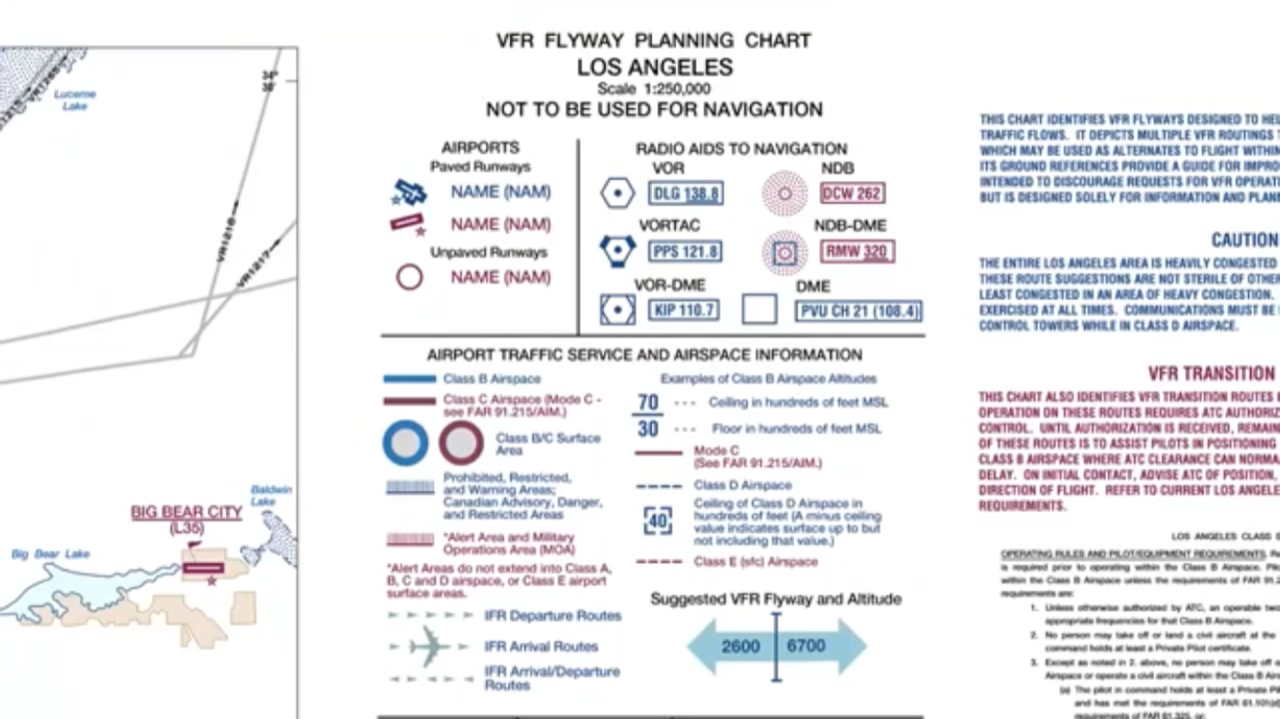
Are they inaccurate? Do they fear litigation? I thought you first had to ask
their permission before they would allow you to sue them.
We spend vast sums of money to equip our airplanes with GPS which is not to be
used for navigation. Now even the government charts are not to be used for
navigation. How about a sticker for the instrument panel that says Not For
Navigation?
Don T.
-
What does this mean? Edward Treadwell, January 6 2020
- Re: What does this mean? Patrick Nuytten, January 6 2020
Results generated by Tiger Technologies Web hosting using MHonArc.